Synergy of Interferometric SAR and Machine/Deep Learning to Assess Natural Hazards
Jan 31, 2024
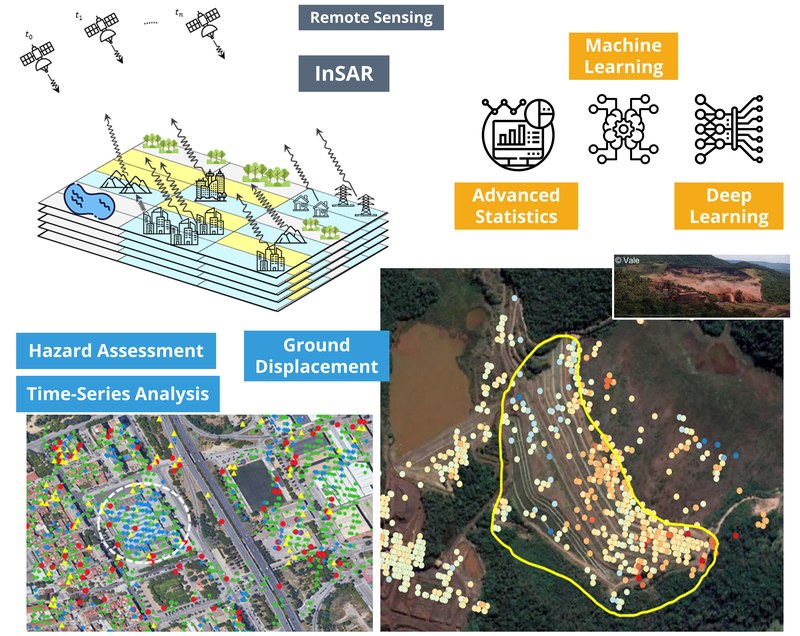
S. Mohammad Mirmazloumi defended his thesis co-supervised by Michele Crosetto and Oriol Monserrat on January 30, 2024 at the Baix Llobregat Campus in the Telecommunications Technology Center of Catalonia (CTTC). The thesis is entitled "Advanced Modeling of InSAR Time Series for Ground Displacement Hazard Assessment".
Natural movements of Earth and human-based activities generate continuous ground displacements, affecting human life and the economy. In order to mitigate and reduce the impact of such displacements, accurate and frequent monitoring of their spatial and temporal characteristics is necessary. Remote sensing technology offers diverse temporal and spatial assets that are suitable for actively monitoring and measuring the intensity of ground displacements. This information can then be used to prevent risks, forecast occurrences, and manage the associated hazards.
One active remote sensing system, known as synthetic aperture radar (SAR), enables accurate and anytime measurements of ground displacements using a technique called interferometric SAR (InSAR). InSAR allows for millimeter scale monitoring of deformations over small to wide areas affected by geohazards such as earthquakes, volcanic activities, landslides, and subsidence.
This PhD study is pursuing development of methodologies to model ground displacements behavior of InSAR time series (TS). Hence, an empirical analysis and modeling of displacements TS is performed to investigate various and dominant trends using robust statistical approaches. To achieve this, an automatic classification tool for InSAR TS is proposed to accurately classify seven types of displacement trends using step-wise statistical tests and conditions. The proposed workflow is applied and evaluated on simulated and real InSAR TS datasets from Barcelona and three landslide cases in Granada, Spain.
A forecasting tool is presented to support the prediction and identification of failures in hazardous regions. The tool is designed as an input for early warning system that utilizes spatio-temporal outcomes from a deep learning model known as long short-term memory (LSTM). It aims to support activation of reliable alarms prior to high-risk events.

Share: